Home

Ten Must See Iron Age Hill Forts In Britain

1 Comment

Republication from heritagedaily

1

A hill fort is a type of earthworks used as a fortified refuge or defended settlement

A hill fort is a type of earthworks used as a fortified refuge or defended settlement, located to exploit a rise in elevation for defensive advantage.

The fortification usually follows the contours of a hill, consisting of one or more lines of earthworks, with stockades or defensive walls, and external ditches. Hill forts developed in the Late Bronze and Early Iron Age, roughly the start of the first millennium BC, and were in use by the ancient Britons until the Roman conquest. There are around 3,300 structures that can be classed as hillforts or similar “defended enclosures” within Britain, all worthy of considering. The following list represents ten of the most impressive examples.

1 : Maiden Castle, Dorset

Maiden Castle is an Iron Age hill fort 2.5 kilometres (1.6 mi) south west of Dorchester, in the English county of Dorset. The name Maiden Castle may be a modern construction meaning that the hill fort looks impregnable, or it could derive from the British Celtic mai-dun, meaning a “great hill.”

The earliest archaeological evidence of human activity on the site consists of a Neolithic causeway enclosure and bank barrow. In about 1800 BC, during the Bronze Age, the site was used for growing crops before being abandoned. Maiden Castle itself was built in about 600 BC; the early phase was a simple and unremarkable site, similar to many other hill forts in Britain and covering 6.4 hectares (16 acres). Around 450 BC it underwent major expansion, during which the enclosed area was nearly tripled in size to 19 ha (47 acres), making it the largest hill fort in Britain and by some definitions the largest in Europe

2

Image Credit : Google Earth
 

More

Myths of British ancestry

Leave a comment

Republication from Prospect Journal

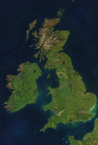
satellite(Image credit: Mapbox)

.

Everything you know about British and Irish ancestry is wrong. Our ancestors were Basques, not Celts. The Celts were not wiped out by the Anglo-Saxons, in fact neither had much impact on the genetic stock of these islands

.
The fact that the British and the Irish both live on islands gives them a misleading sense of security about their unique historical identities. But do we really know who we are, where we come from and what defines the nature of our genetic and cultural heritage? Who are and were the Scots, the Welsh, the Irish and the English? And did the English really crush a glorious Celtic heritage? Everyone has heard of Celts, Anglo-Saxons and Vikings. And most of us are familiar with the idea that the English are descended from Anglo-Saxons, who invaded eastern England after the Romans left, while most of the people in the rest of the British Isles derive from indigenous Celtic ancestors with a sprinkling of Viking blood around the fringes.Yet there is no agreement among historians or archaeologists on the meaning of the words “Celtic” or “Anglo-Saxon.” What is more, new evidence from genetic analysis (see note below) indicates that the Anglo-Saxons and Celts, to the extent that they can be defined genetically, were both small immigrant minorities. Neither group had much more impact on the British Isles gene pool than the Vikings, the Normans or, indeed, immigrants of the past 50 years.The genetic evidence shows that three quarters of our ancestors came to this corner of Europe as hunter-gatherers, between 15,000 and 7,500 years ago, after the melting of the ice caps but before the land broke away from the mainland and divided into islands. Our subsequent separation from Europe has preserved a genetic time capsule of southwestern Europe during the ice age, which we share most closely with the former ice-age refuge in the Basque country. The first settlers were unlikely to have spoken a Celtic language but possibly a tongue related to the unique Basque language.

More

Iron Age and Anglo-Saxon genomes from East England reveal British migration history

1 Comment

001.

002

A very interesting ethno-political map of Britain in AD 530 (above) based on the archaeological map below, the literary sources and other data (maps credit: Home Page for Howard Wiseman in Griffith Univ., maps added by periklisdeligiannis.wordpress.com)

.

Republication from Nature.com


Stephan Schiffels, Wolfgang Haak, Pirita Paajanen,  Bastien Llamas, Elizabeth Popescu, Louise Loe, Rachel Clarke, Alice Lyons, Richard Mortimer, Duncan Sayer, Chris Tyler-Smith,   Alan Cooper & Richard Durbin

Nature Communications7,  Article number:10408  doi:10.1038/ncomms10408


British population history has been shaped by a series of immigrations, including the early Anglo-Saxon migrations after 400 CE. It remains an open question how these events affected the genetic composition of the current British population. Here, we present whole-genome sequences from 10 individuals excavated close to Cambridge in the East of England, ranging from the late Iron Age to the middle Anglo-Saxon period. By analysing shared rare variants with hundreds of modern samples from Britain and Europe, we estimate that on average the contemporary East English population derives 38% of its ancestry from Anglo-Saxon migrations. We gain further insight with a new method, rarecoal, which infers population history and identifies fine-scale genetic ancestry from rare variants. Using rarecoal we find that the Anglo-Saxon samples are closely related to modern Dutch and Danish populations, while the Iron Age samples share ancestors with multiple Northern European populations including Britain.

More

Y Chromosome Evidence for Anglo-Saxon Mass Migration

3 Comments


britain 6th cent.

Britain in the 6th century (suggested  or approximate boundariess). The Anglo-Saxon principalities or tribes are noted in red, the Briton principalities in black, the Irish in blue and the Pictish in brown. The Attecotti of the northern edge being ethnologically indecipherable, are noted in their own colour. In the 7th cent., the Angles of Bernicia, Deira and Lindsey were united in the large kingdom of Northumbria.  Bernicia, Deira and then  Nortumbria destroyed and conquered the Briton kdms of Bryneich, Ebrauc, Elmet and South Rheged. Mercia conquered South Elmet and a part of Luitcoyt. The territory of Lundein (London) was annexed mainly by Essex (East Saxons) and East Anglia, and Regia by Sussex (South Saxons). Finally Wessex joined by the Gewissae (possibly descendants of Germanic soldiers of Rome), managed to destroy and annex the Briton kdms of Glouvia, Cerin and Atrebatia, pressing hard towards Dumnonia (possibly Arthur’s homeland). A part of the Dumnonii had already fled to Armorica founding the colony of Domnonee. It seems that the principality of Kerrnev in Armorica was also a Briton colony originated from Cerniw of Cornwall. The name of Leon in Armorica probably originates from a Celtic verbal corruption of the Latin ‘Legion’ but it cannot be defined if this principality had Briton origins. The Scots (Irish) of Dal Riada had already colonized modern Argyll pressing the Pictish principalities (map and caption added by P. Deligiannis ).

.

Republication from mbe.oxfordjournals.org

.

Michael E. Weale*,1, Deborah A. Weiss,1, Rolf F. Jager*‡, Neil Bradman* and  Mark G. Thomas*

Abstract

British history contains several periods of major cultural change. It remains controversial as to how much these periods coincided with substantial immigration from continental Europe, even for those that occurred most recently. In this study, we examine genetic data for evidence of male immigration at particular times into Central England and North Wales. To do this, we used 12 biallelic polymorphisms and six microsatellite markers to define high-resolution Y chromosome haplotypes in a sample of 313 males from seven towns located along an east-west transect from East Anglia to North Wales. The Central English towns were genetically very similar, whereas the two North Welsh towns differed significantly both from each other and from the Central English towns. When we compared our data with an additional 177 samples collected in Friesland and Norway, we found that the Central English and Frisian samples were statistically indistinguishable. Using novel population genetic models that incorporate both mass migration and continuous gene flow, we conclude that these striking patterns are best explained by a substantial migration of Anglo-Saxon Y chromosomes into Central England (contributing 50%–100% to the gene pool at that time) but not into North Wales.

More

The genetic structure of the British population

Leave a comment

Republication from Nature

02

Each row represents one of the 51 European groups (labels at right) that were inferred by clustering the 6,029 European samples using fineSTRUCTURE. Only European groups that make at least 2.5% contribution to the ancestry profile of at least one UK cluster are shown. Each column represents a UK cluster. Coloured bars have heights representing the proportion of the UK cluster’s ancestry best represented by that of the European group labelled with that colour. The map shows the location (when known at regional level) of the samples assigned to each European group (some sample locations are jittered and/or moved for clarity, see Methods). Lines join group labels to the centroid of the group, or collection of groups (Norway, Sweden, with individual group centroids marked by group number). © EuroGeographics for the administrative boundaries.

.

01a, The routes taken by the first settlers after the last ice age. b, Britain during the period of Roman rule. c, The regions of ancient British, Irish and Saxon control. d, The migrations of Norse and Danish Vikings. The main regions of Norse Viking (light brown) and Danish Viking (light blue) settlement are shown. © EuroGeographics for the administrative boundaries (coastlines).

More